

Drones have revolutionized countless industries, and real estate is at the forefront of this transformative technology. No longer limited to static ground-level shots, drone real estate photography allows you to capture breathtaking bird's-eye views, sweeping panoramas, and awe-inspiring perspectives that will leave potential buyers mesmerized.
In this article, we will guide you through the art of drone real estate photography. From choosing the right equipment to expert tips on composition and editing, we'll help you master every step of the process. Whether you're a seasoned real estate professional or a photographer looking to explore new horizons, join us on this adventure as we showcase properties from unique perspectives and make an unforgettable impact.
What is Real Estate Drone Photography?
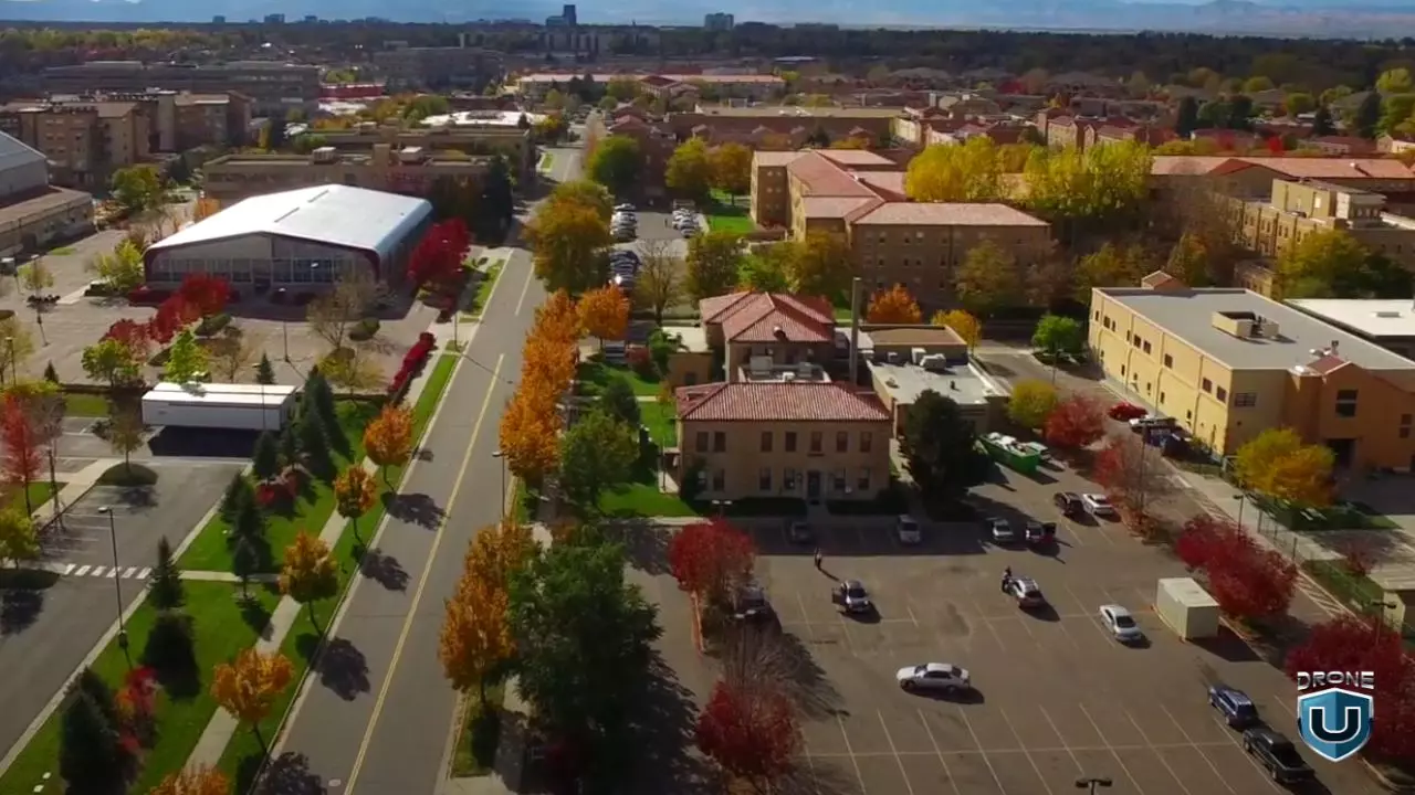
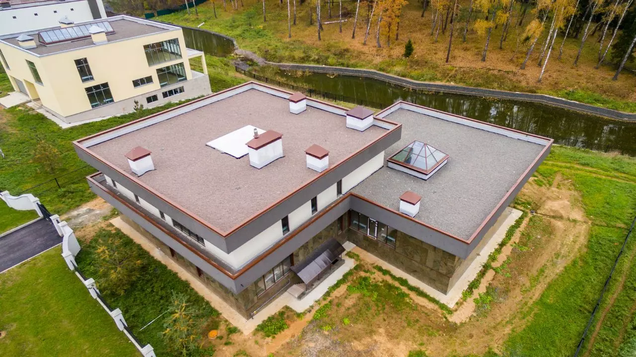
Real estate drone photography involves using unmanned aerial vehicles (UAVs) to capture high-quality images and videos of properties. Drones surpass traditional photography methods by offering unique angles and perspectives. With high-resolution cameras mounted on drones, you can capture stunning aerial views of properties, including the surrounding landscape and neighborhood.
Why Use Drone Photography for Real Estate Listings?
Here are the key benefits of using drone photography for real estate listings:
Stunning Aerial Views
Real estate drone photography captivates your audience with striking visuals. Showcasing a property's surroundings from an aerial viewpoint creates a visually stunning experience that captures the attention of potential buyers.
Enhancing Visual Appeal
Drone photography offers potential buyers a comprehensive overview of a property's layout, size, and location. Presenting properties from an elevated vantage point provides a fresh visual appeal.
Increased Interest
Drone photos attract more views and expedite sales compared to listings without such visuals. The uniqueness and comprehensiveness of drone photos enable potential buyers to envision themselves living in the property. They also effectively showcase amenities, such as proximity to schools, markets, and parks.
Competitive Advantage
In a saturated real estate market, differentiation is crucial. Incorporating drone photography in your marketing strategy provides a valuable competitive advantage, enticing a larger client base. Drone photos leave a lasting impression on buyers, elevating listings and maximizing the likelihood of a successful sale.
Captivating Virtual Tours
Combining drone real estate photography with videography brings captivating virtual property tours to life. These tours blend aerial and ground-level shots, providing potential buyers with a holistic understanding of the property. The dynamic fusion of perspectives offers an engaging experience, allowing viewers to explore the property from multiple angles.
Saving Time and Money
Real estate drone photography is efficient and cost-effective. With drones, you can capture breathtaking aerial photos efficiently, eliminating the need for extensive setup.
How to Take Real Estate Photos Using Drones
To capture stunning real estate photos with drones, follow these steps:
1. Choose the Right Drone
When selecting a drone for real estate photography, consider factors like image quality, battery life, and stability. Look for drones with advanced camera capabilities, stable flight controls, and extended battery life. Opt for a drone with a high-resolution camera and features like adjustable exposure settings and RAW format shooting for post-processing flexibility.
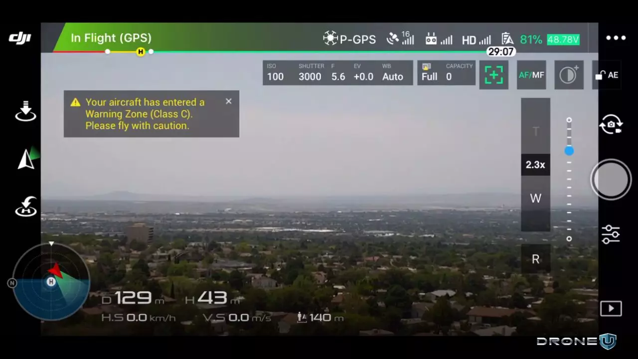
2. Obtain Necessary Permits
Before using drones for commercial purposes, ensure you acquire the required permits and licenses from the relevant authorities. Familiarize yourself with local regulations and obtain the necessary certifications to operate drones legally.
3. Before the Mission
Before heading out for a drone photo shoot, conduct thorough research and visit the property to understand its layout and potential obstacles. Plan your shots based on the property's unique selling points, considering the time of day and weather conditions that will best showcase the property. Planning ahead ensures you capture the shots you need efficiently and effectively.
4. During the Mission
- Shoot during the "golden hour" shortly after sunrise or before sunset to capture warm, soft lighting that enhances the property's appeal. Avoid harsh midday sunlight.
- Use drone shots strategically to highlight important features and capture unique perspectives. Combine aerial shots with ground-level shots to showcase the interior and exterior of the property.
- Apply traditional photography principles like the rule of thirds, leading lines, and symmetry to create visually appealing compositions. Experiment with different angles, altitudes, and focal lengths to add variety to your shots.
5. Editing and Post-Processing
After capturing your photos, enhance their quality through editing and post-processing. Use photo editing software like Adobe Photoshop or Adobe Lightroom to adjust and enhance the images. Keep the edits natural and real, ensuring you maintain the trust and honesty of your audience.
Expert Tips on Drone Real Estate Photography and Videography
Here are some simple yet effective tips to create stunning visuals that will help sell your property faster:
- Capture real estate drone photography and videography during sunrise and sunset for desirable lighting conditions.
- Consider shooting night-time footage and use portable lighting solutions to enhance the property's exterior.
- Highlight property features by clearing debris and turning on lights to enhance the appeal of your photos and videos.
- Showcase the property's relationship with the neighborhood and nearby amenities without excessively high aerial shots.
- Aim for smooth footage by minimizing jerky movements during drone flights. Consider wind direction to eliminate jerks in the footage.
- Use a higher frame rate to slow down video shots without sacrificing smoothness.
- Experiment with different maneuvers and shots to enhance real estate videography, such as "reveal" shots that gradually unveil the subject property.
Capturing Interior Real Estate Photos and Videos with DJI Osmo
 Using DJI Osmo for interior real estate photography and videography has its benefits. Mounting the Osmo on a suction cup or slider provides better control and smoother movement. You can tilt the Osmo through an app, which makes it easier to achieve desired shots with less post-production work.
One effective technique is to mount the Osmo on a suction cup in the corner of a room to capture the entire length and breadth, making the room appear more spacious. Overcoming challenges such as WiFi and interference can be done by turning on lights and fans and focusing on highlights like fireplaces to enhance video quality.
Real Estate Drone Photography Pricing
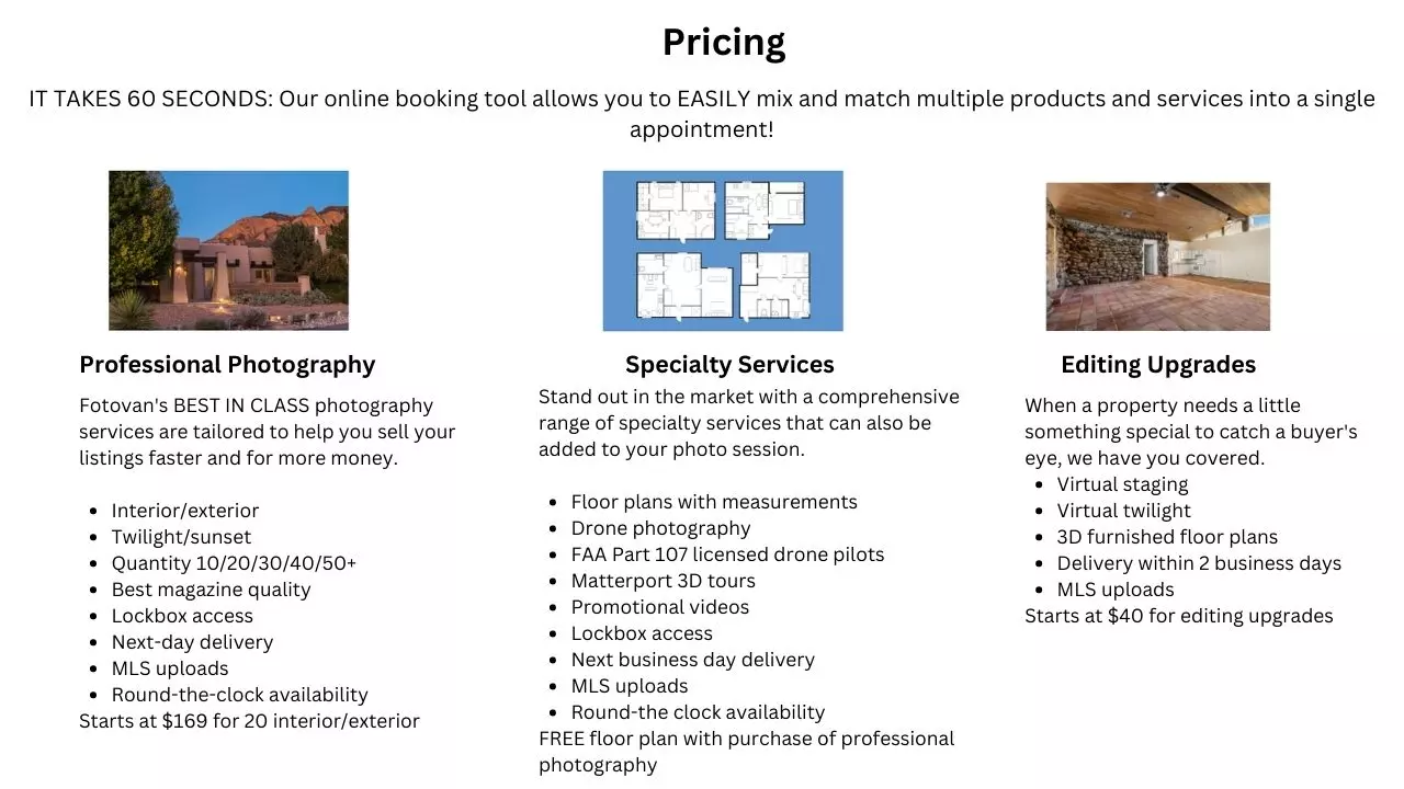 The pricing for real estate drone photography varies based on factors such as location, property size, and project scope. Offering multiple options, from low-end to high-end packages, is a smart negotiation strategy. Aerial photos can be upsold to clients for added value.
Pricing for drone real estate photography can range from a few hundred to a few thousand dollars. Factors like skill level, experience, and market demand also influence income potential. Consider local market conditions and adjust pricing accordingly to ensure fair compensation for your services.
Frequently Asked Questions
Can anyone use drones for real estate photography?
Yes, anyone can use drones for real estate photography, provided they adhere to local regulations and obtain the necessary permits and licenses.
How much does real estate drone photography cost?
The cost of real estate drone photography varies depending on location, property size, and scope. On average, prices can range from a few hundred to a few thousand dollars.
Are there any legal restrictions or regulations for real estate drone photography?
Yes, there are legal restrictions and regulations for drone photography in real estate that vary from country to country. Familiarize yourself with local regulations to ensure compliance before operating a drone for real estate photography.
How can drone photography for real estate benefit commercial properties?
Aerial photography can be advantageous for commercial properties by showcasing proximity to main roads, transportation hubs, and commercial centers. This helps attract potential buyers looking for office buildings, shopping centers, or industrial spaces.
Can drones for real estate be used for property inspections?
Yes, real estate drones can be used for property inspections, even in hard-to-reach or dangerous areas.
Conclusion
In conclusion, drone photography for real estate offers a unique and innovative way to stand out in a competitive market. By carefully planning, selecting the right equipment, and having an eye for composition, you can create impressive real estate listings that captivate potential clients. Embrace the power of drone technology and elevate your property showcase like never before!


